贪吃蛇游戏的AI算法
Snake
AI of snake game.
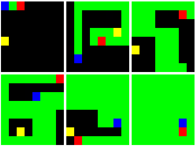
We hope the snake to eat food and make the map filled with its bodies as soon as possible , so it should not always follow a fixed zigzag pattern to eat food.
Demo
Installation
-
Install CMake .
-
Build this project using below commands:
$ mkdir build
$ cd build
$ cmake ..
-
In directory
build, you could find:- A Makefile for Linux
- A Visual Studio project for Windows
- An Xcode project for OS X
Keyboard Control
| Key | Feature |
|---|---|
| W | move up |
| A | move left |
| S | move down |
| D | move right |
| Space | pause/resume the snake |
| Esc | exit game |
AI Strategy
-
Snake.decideNext(): compute the next move direction D of the snake S1
-
Compute the shortest path P1 from the snake S1 's head to food.
-
Move a virtual snake S2 (the same as S1 ) to eat the food along path P1 .
-
Compute the longest path P2 from the snake S2 's head to its tail. If P2 exists, let D be the first direction in path P1 . Otherwise go to step 4.
-
Compute the longest path P3 from the snake S1 's head to its tail. If P3 exists, let D be the first direction in path P3 . Otherwise go to step 5.
-
Let D be the direction that makes the snake the farthest from food.
-
-
Map.findMinPath(): compute the shortest path between two positions
The algorithm is based on BFS. In order to make the result path as straight as possible, each time when traversing the adjacent positions, the position at current searching direction will be traversed first.
Here is a vivid description of how it works:
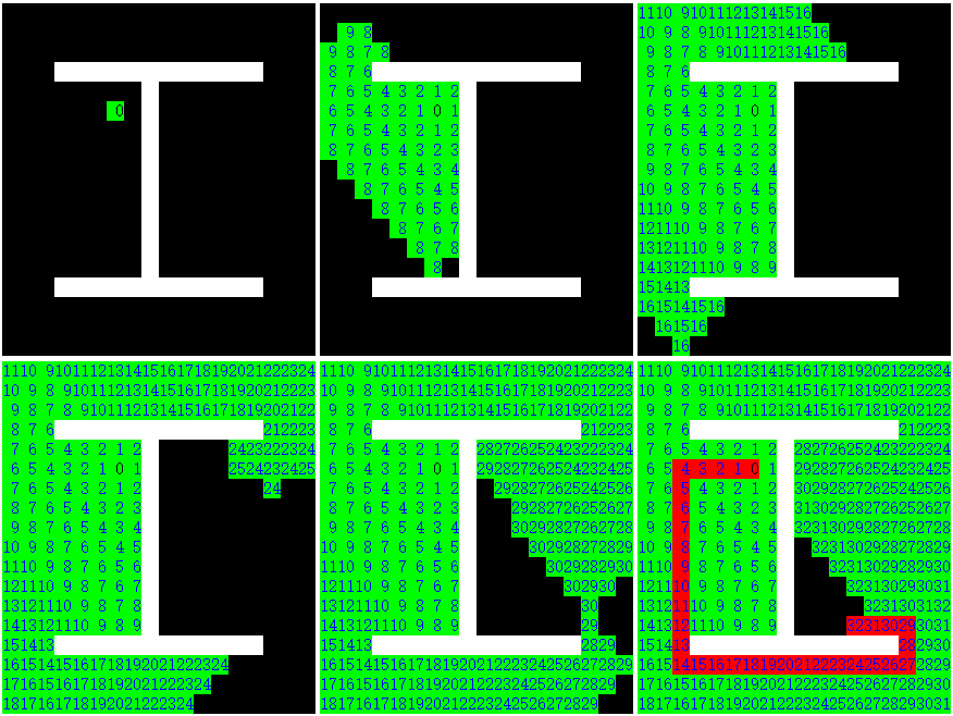
(The green area is scanned when searching and the red area is the shortest path. Each number on the point denotes its minimum distance to the start point.)
-
Map.findMaxPath(): compute the longest path between two positions
The algorithm is based on DFS and the greedy algorithm. Each time when traversing the adjacent positions, the position that is the farthest(estimated by Manhatten distance) from the destination will be traversed first. In addition, in order to make the result path as straight as possible, if two positions have the same distance to the destination, the position at current searching direction will be traversed first. Since this is an NP-hard problem, this method is only approximate.
Here is a vivid description of how it works:
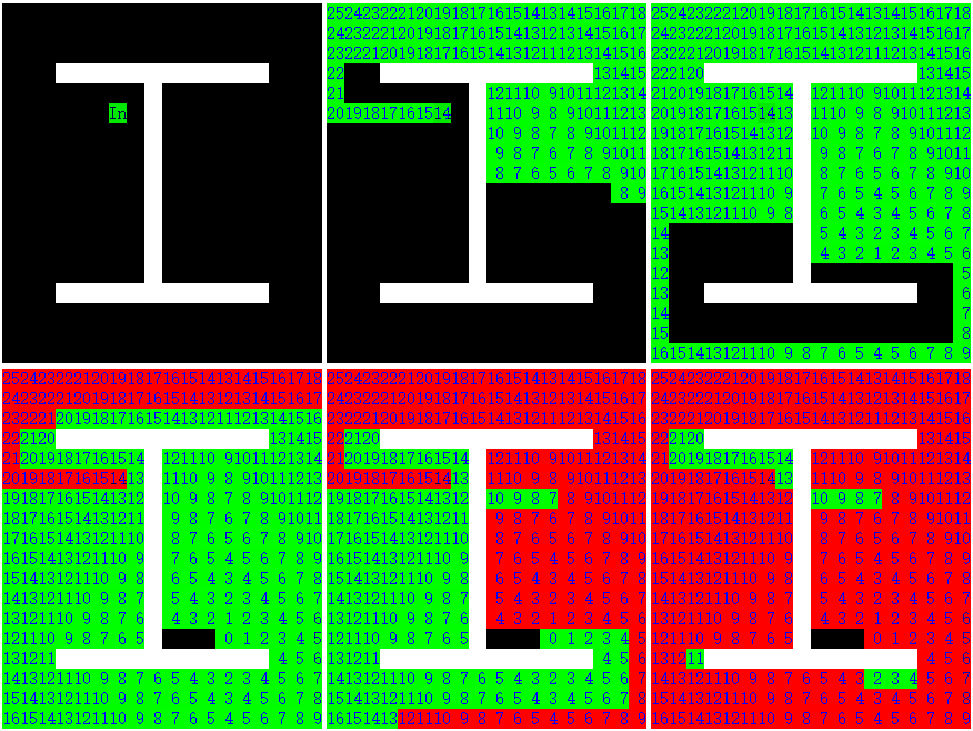
(The green area is scanned when searching and the red area is the longest path. Each number on the point denotes its estimated distance to the destination.)
License
See theLICENSE file for license rights and limitations.


![[HBLOG]公众号](https://www.liuhaihua.cn/img/qrcode_gzh.jpg)
